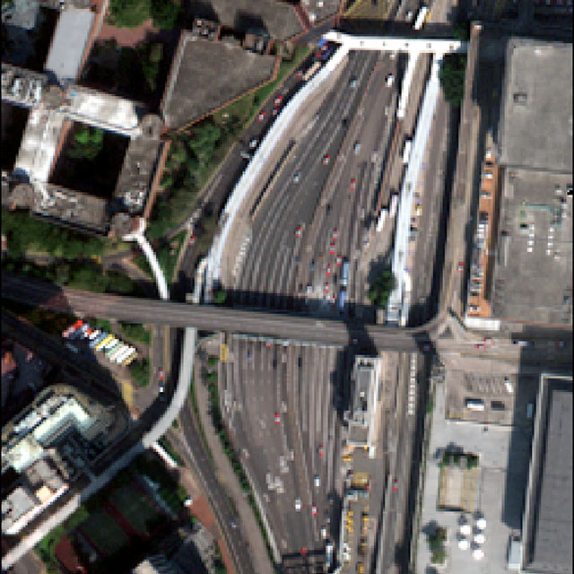
WORLDVIEW-3 IMAGE PAN-SHARPENING TECHNIQUE
Viewer

Original Image Original
Pan-sharpened Image Pan-sharpened

WorldView-3 satellite data acquired over Hong Kong on 1 January 2015.
(Image Copyright © DigitalGlobe)

Can you see the difference?


Pansharpening is a process of merging high-resolution panchromatic and lower resolution multispectral imagery to create a single high-resolution color image. Google Maps and nearly every map creating company use this technique to increase image quality. Pansharpening produces a high-resolution color image from three, four or more low-resolution multispectral satellite bands plus a corresponding high-resolution panchromatic bands.

This is a placeholder for the question regarding this page?

  1. Here is the question 1.
  2. Here is the question 2.

Try to create your own Pan-sharpened image!


Copyright (C) 1986-2016 Geocarto International Centre Ltd. All Rights Reserved.