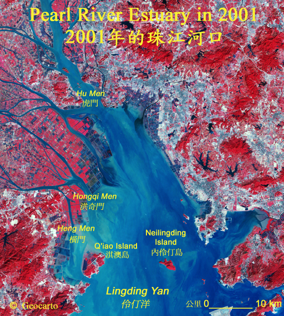
Hong Kong and Pearl River Over Years
多年來的香港及珠江三角洲
Click to See in Detail
點擊以下圖像以放大。
Hong Kong from Space
從太空看香港
|
|
|---|---|
|
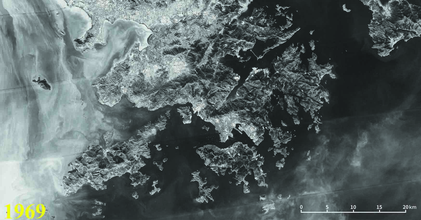
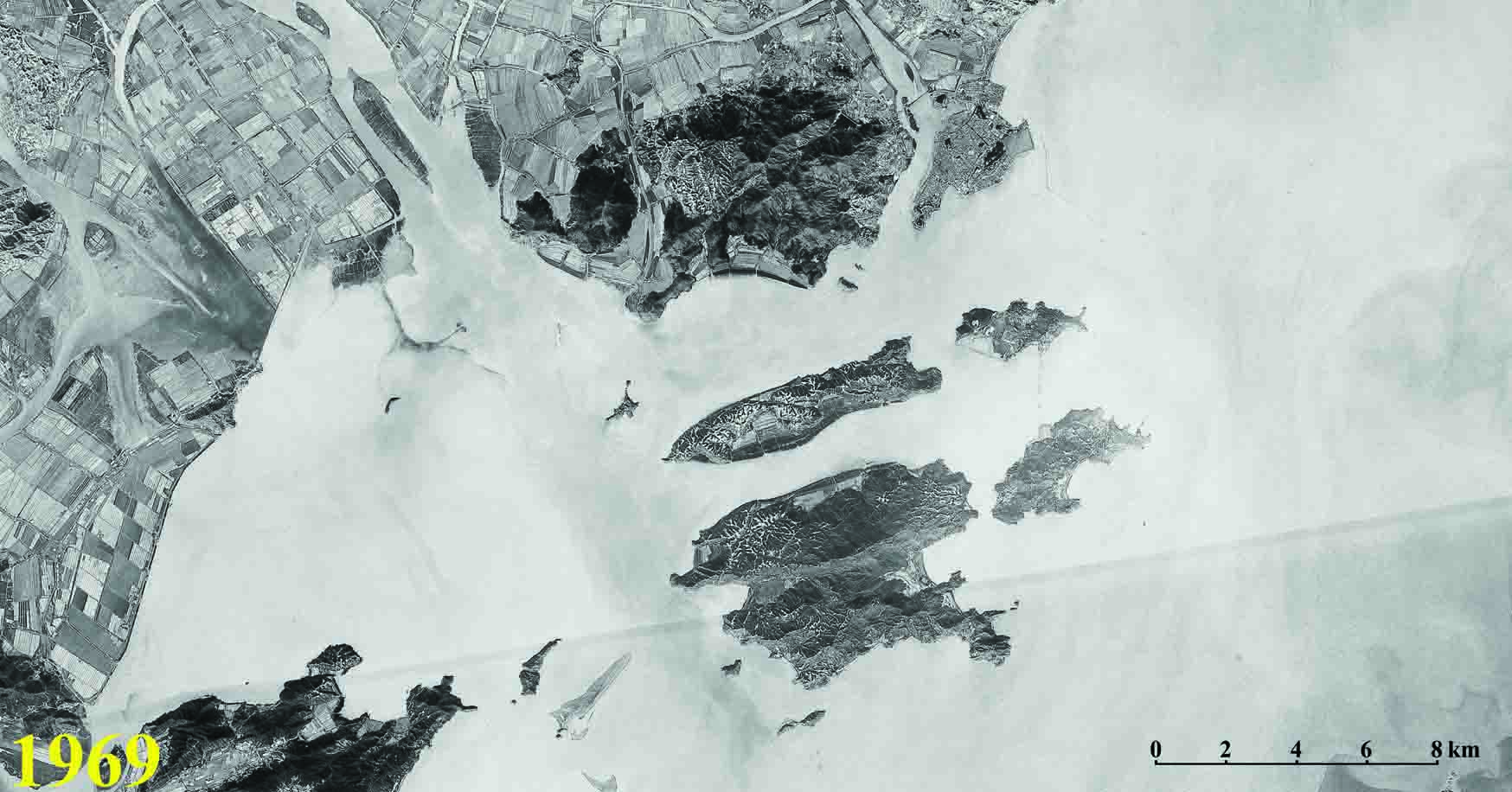
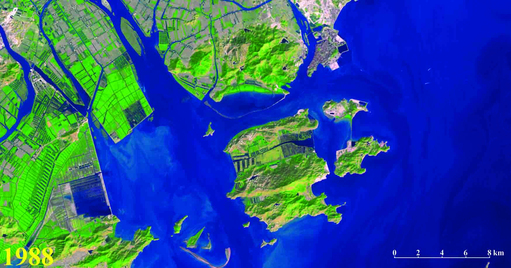
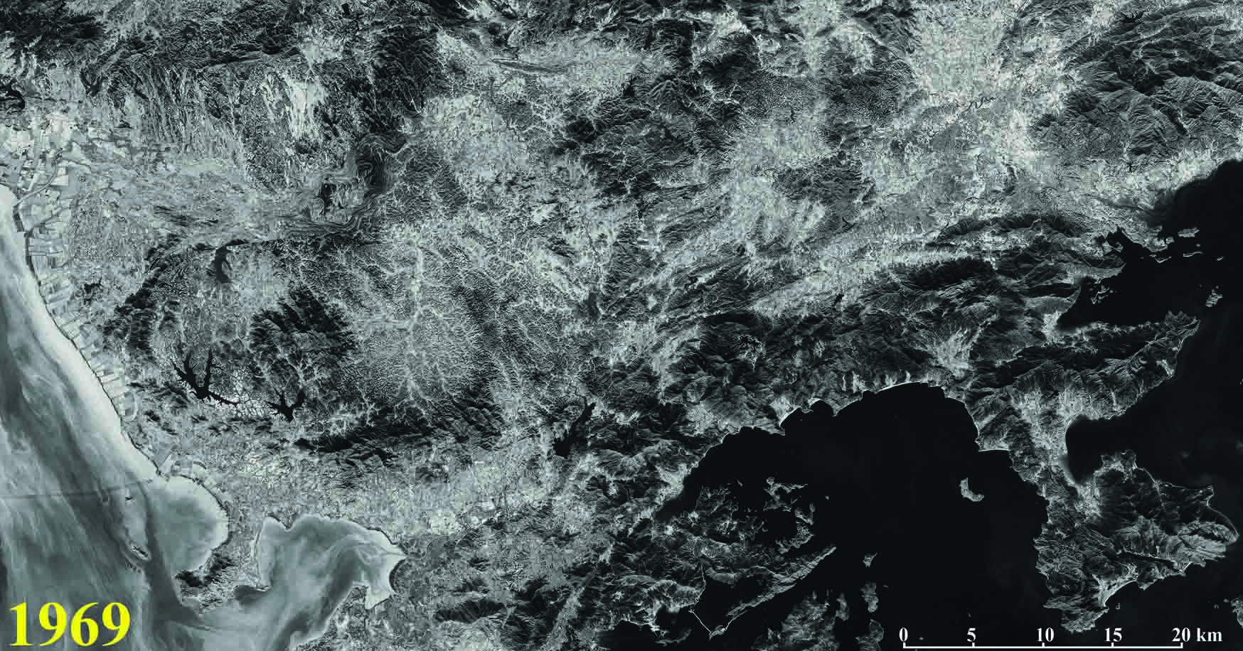
Hong Kong in 1969 |
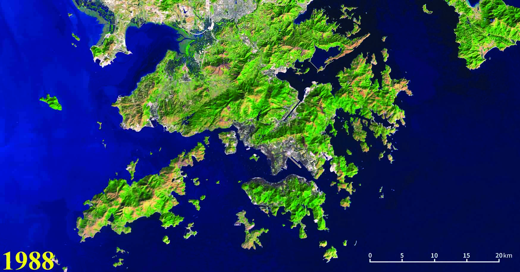
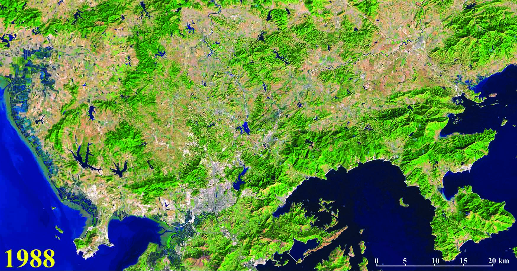
Hong Kong in 1988 |
|
|
|
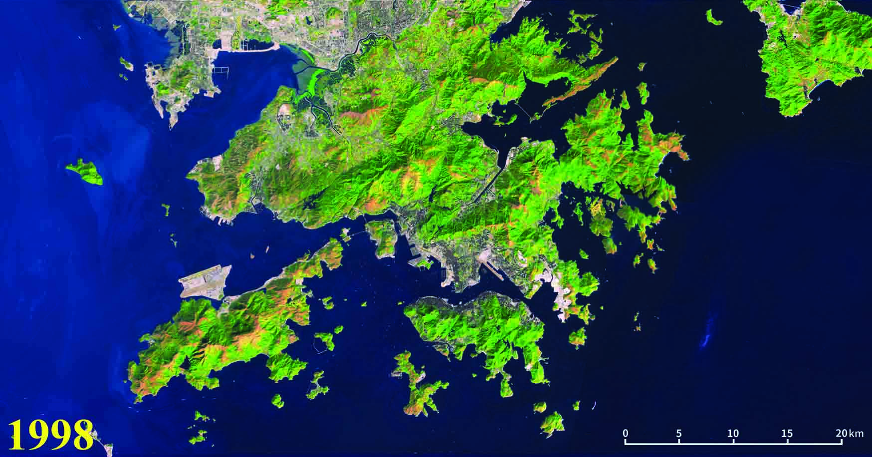
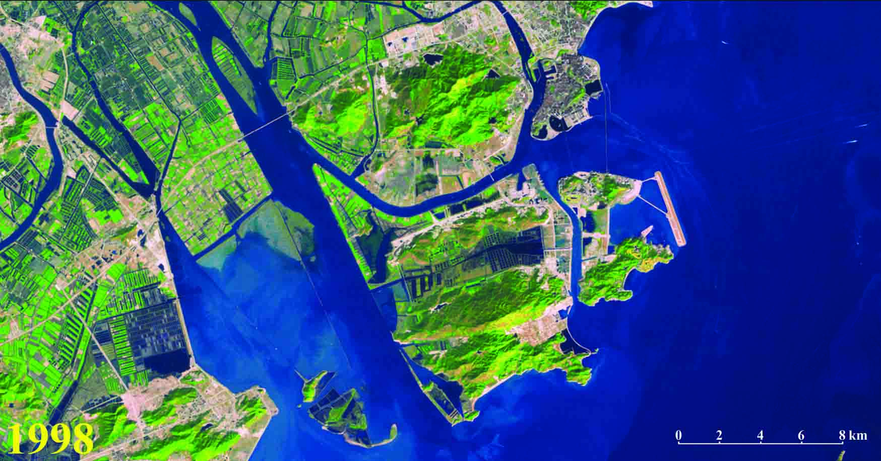
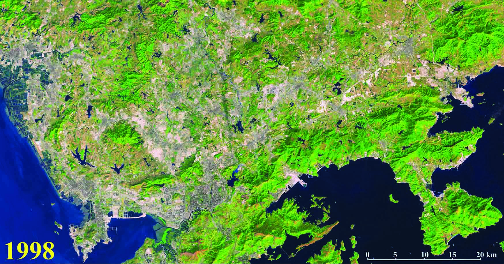
Hong Kong in 1998 |
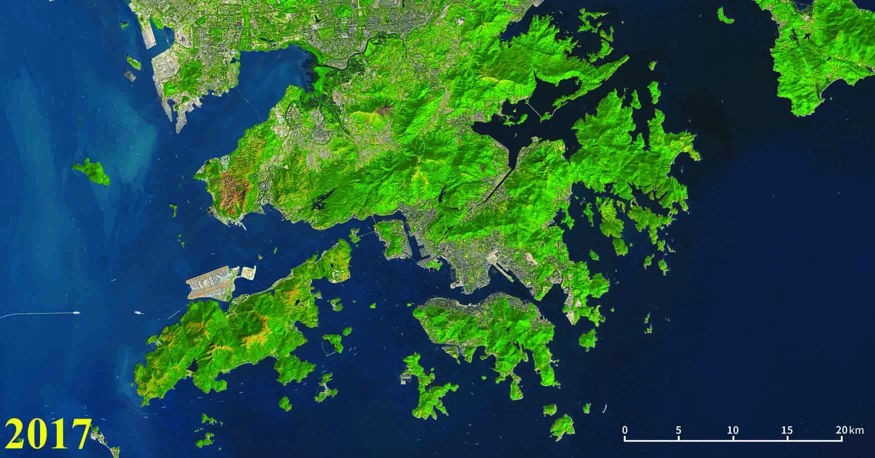
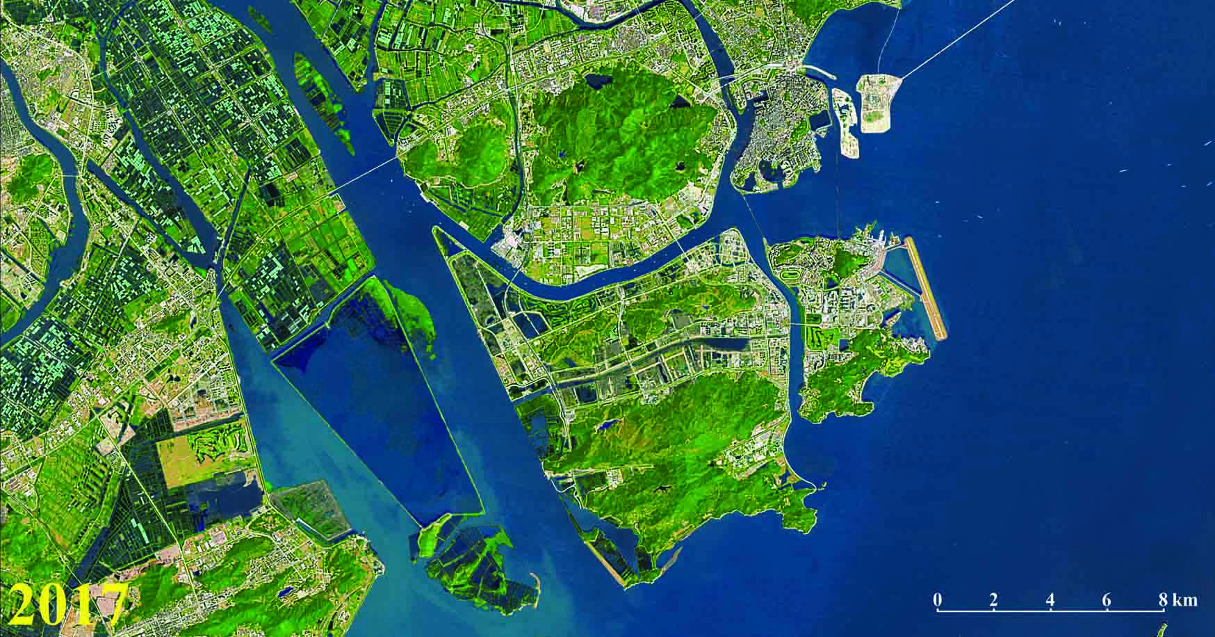
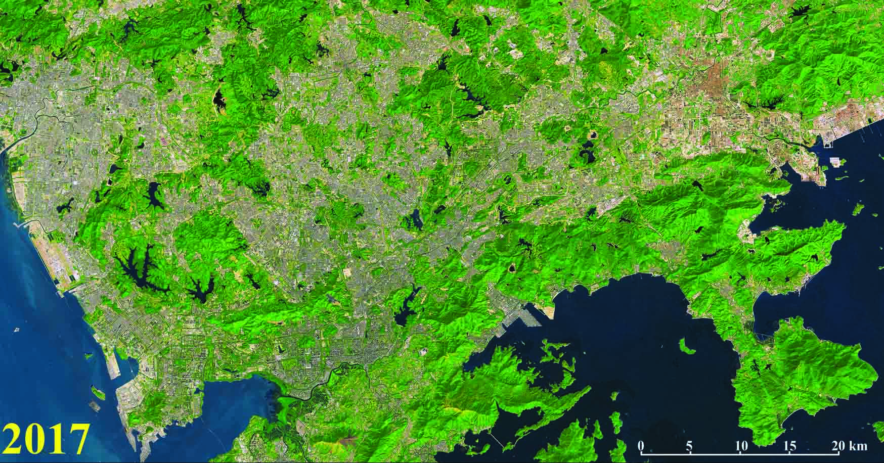
Hong Kong in 2017 |
|
|
|
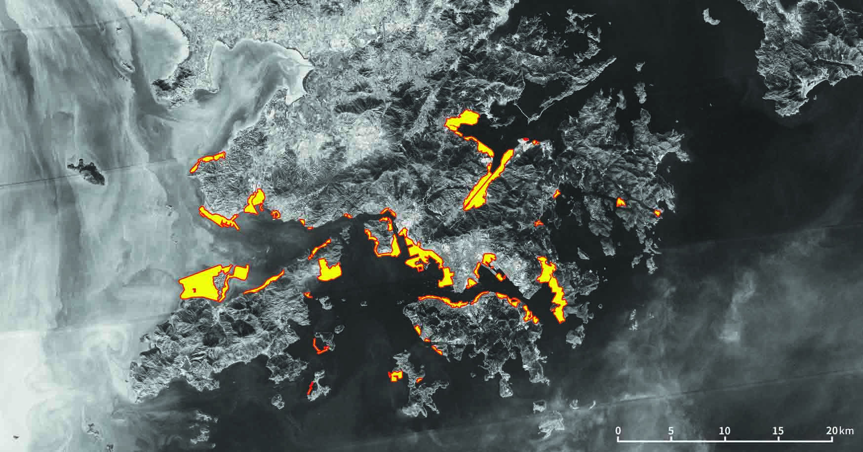
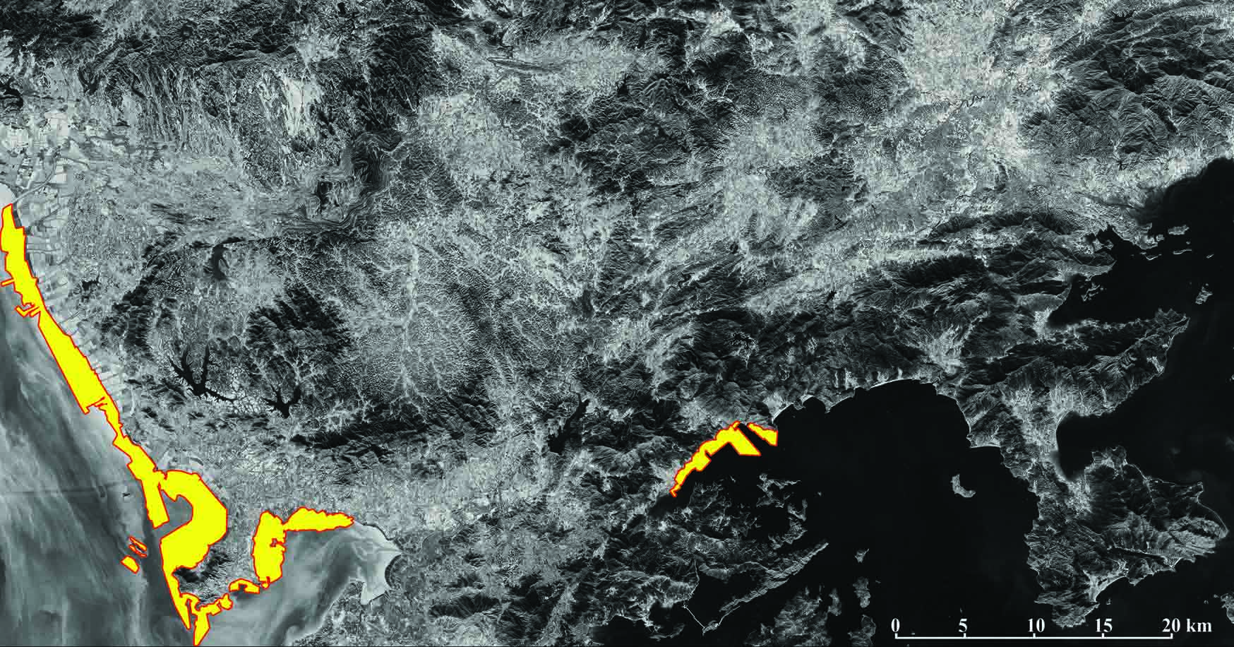
Reclamation map of Hong Kong from 1969 to 2017 |
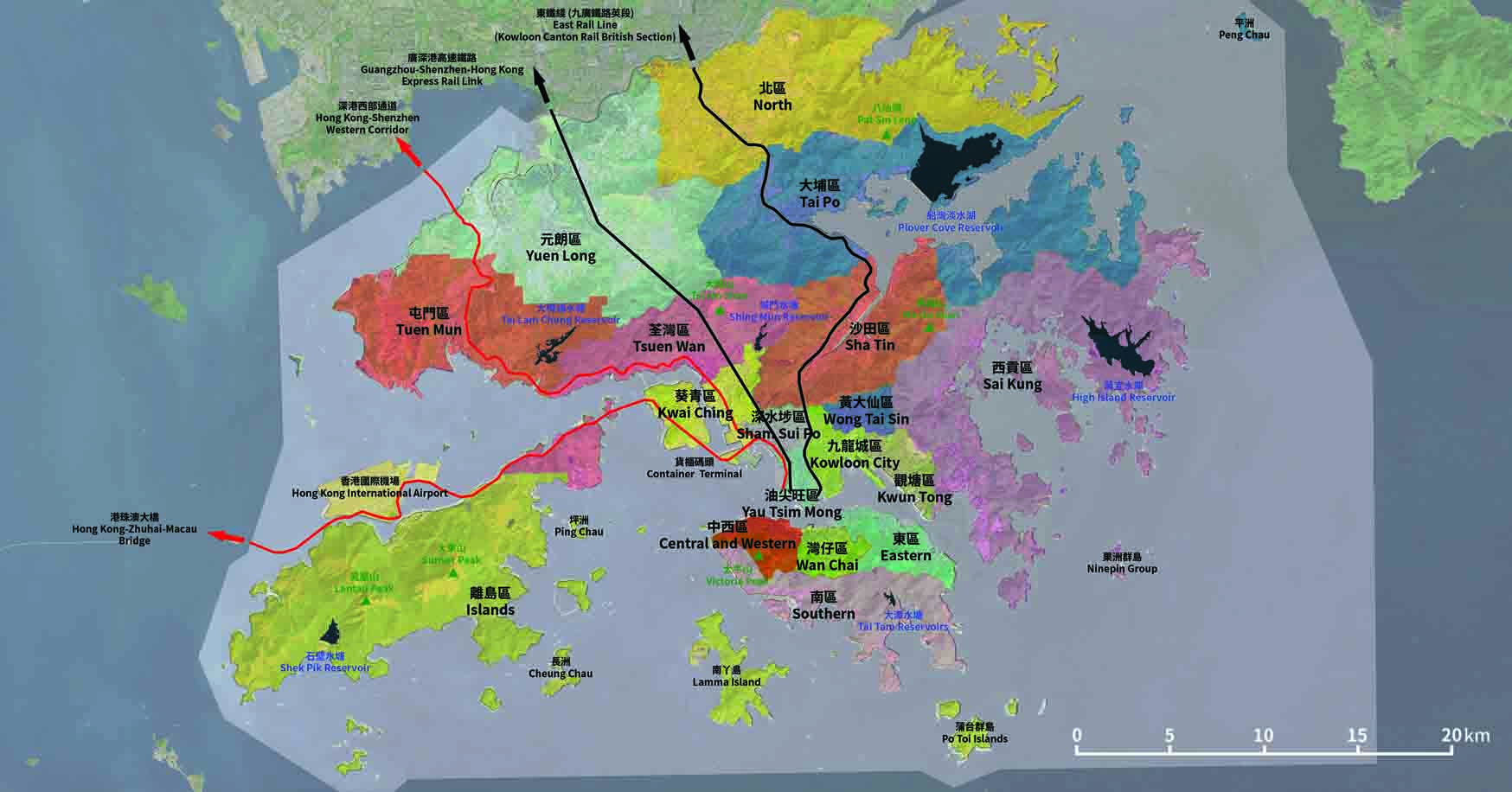
Map of Hong Kong |
|
|
|
Macau from Space
從太空看澳門
|
|
|---|---|
|
Macau in 1969 |
Macau in 1988 |
|
|
|
Macau in 1998 |
Macau in 2017 |

|

|
|
Reclamation map of Macau from 1969 to 2017 |
Map of Macau |
|
|
|
Shenzhen from Space
從太空看深圳
|
|
|---|---|
|
Shenzhen in 1969 |
Shenzhen in 1988 |
|
|
|
Shenzhen in 1998 |
Shenzhen in 2017 |
|
|
|
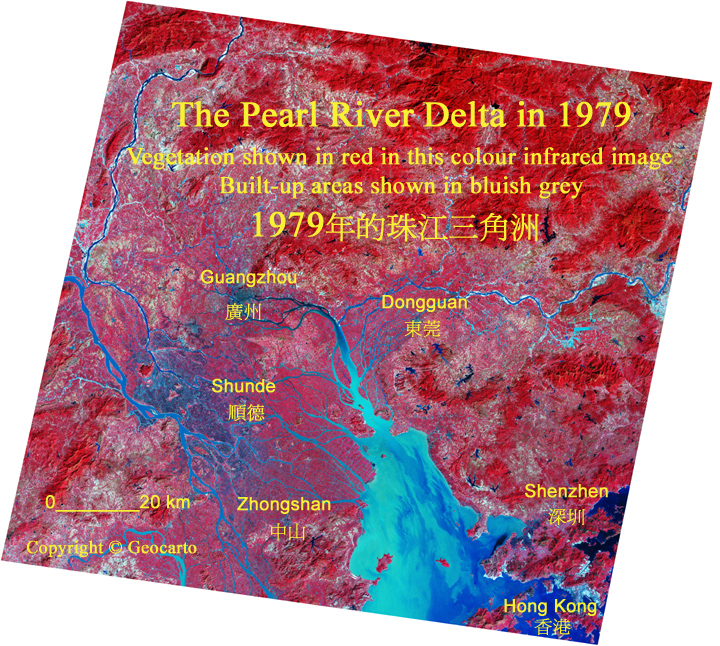
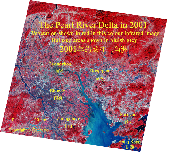
Reclamation map of Shenzhen from 1969 to 2017 |
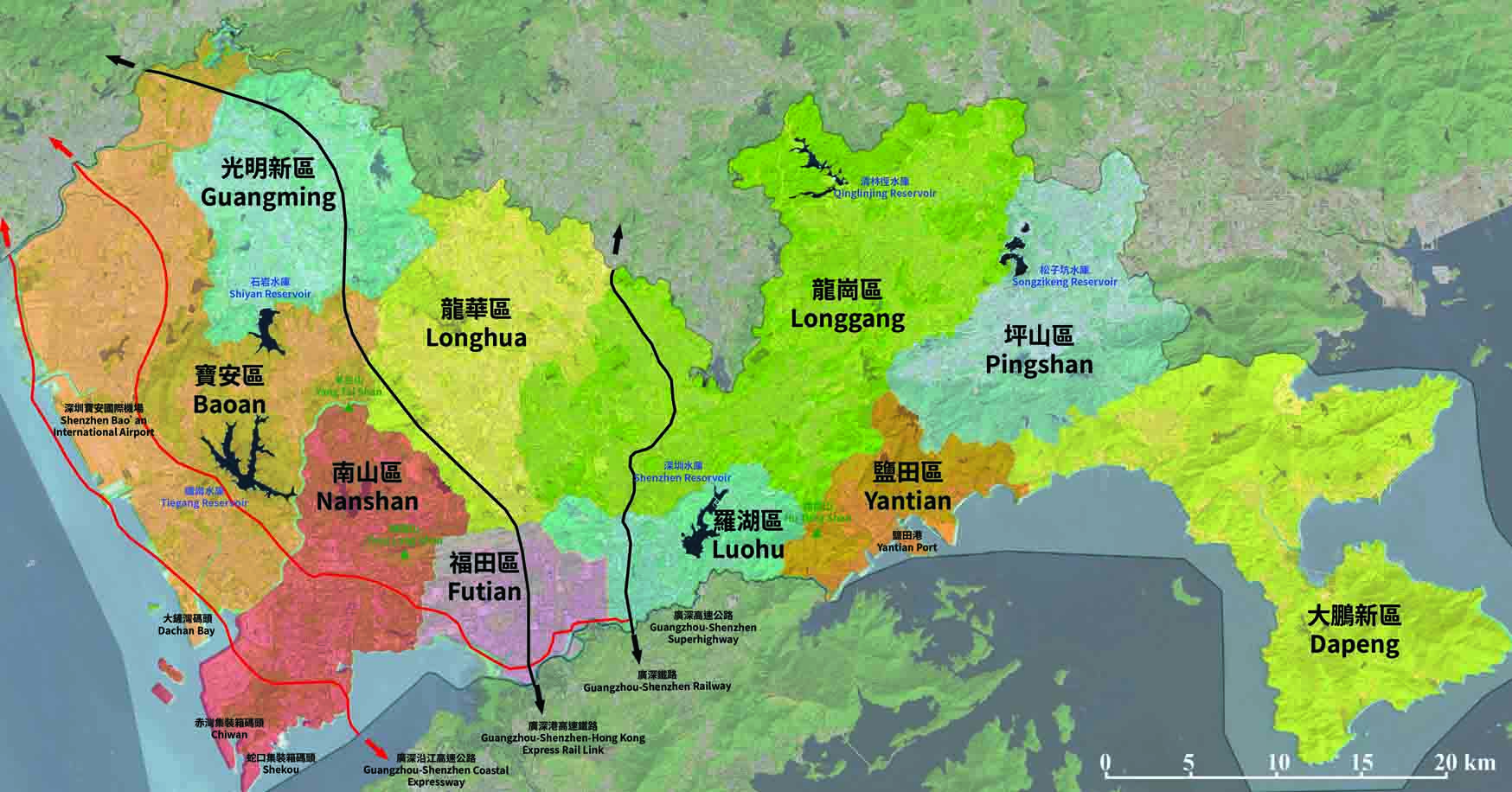
Map of Shenzhen |
|
|
|
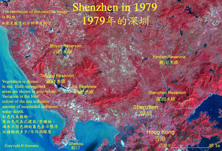
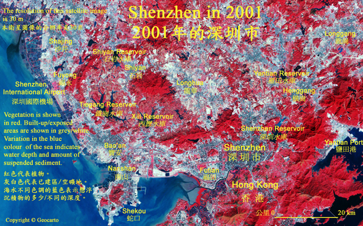
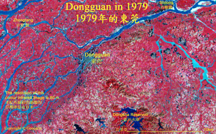
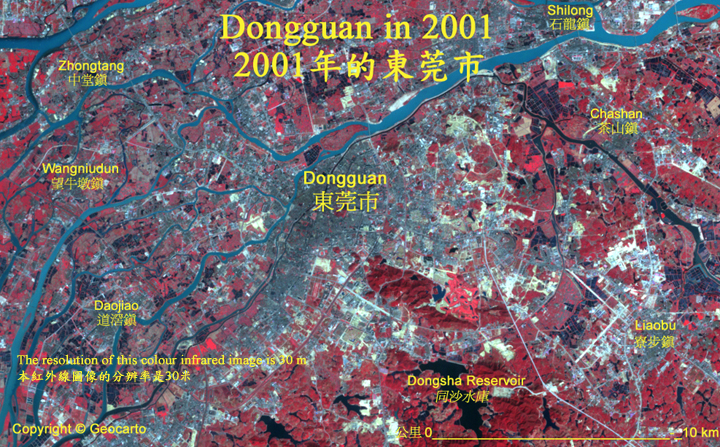
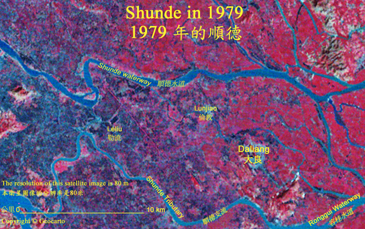
Hong Kong in False Colour Infra-red
香港紅外線假色照片
Contrast between Vegetation and Built-up Areas
植被與建成區的對比

|
|
|
|
|
|
|
|
|
|
|
|